Straand Hotel
The tour starts at the venerable Straand Hotel.Ever since the first skyscrapers entered Straand in 1864, Straand Hotel has provided comfort and good service with the guest in focus.The hospitality and good traditions have been passed on from generation to generation, and more than 150 years later you can still feel at home when you’re here.A very special atmosphere can be found in the old part, which lives on as a central part of the new hotel.If the sturdy timber walls of the cozy living rooms were to speak, they would have many stories to tell about the life and activities of earlier times.Straand has an interesting and colorful past that today’s 5th generation hosts, Katrine & Lars Arne Straand, are both proud of and want to carry on.
Dalen
The tour continues to Dalen with a stop at yet another hotel with historical flair. The hotel, which is also known as the “fairytale hotel”, was built in 1894 and has a sumptuous, romantic style with dragon heads, towers, spires, balconies, projections and cornices. The valley is the terminus of the Telemark Canal, which is the waterway from Skien, and which when completed was called “the eighth wonder of the world” in European travel guides.
Møsvatn
Welcome to beautiful Møsvatn. Møsvatn is Vestfold and Telemark’s largest lake, and part of Hardangervidda. Situated at 900 meters above sea level, it is Scandinavia’s highest lake. Møsvatn and the surrounding areas boast fish in the water and reindeer on the plateau. Enjoy the views and nature on your way to the industrial adventure along the waterway
Krokan
Krokan is Norway’s first tourist lodge, and a very important starting point for what the Norwegian Tourist Association is today. This is one of the original sites for the concept of “it’s typically Norwegian to go on a hike”, which was something townspeople came to Krokan to do in the old days.
Maristigen
The hike has come to Maristigen. A terrifyingly steep but exciting gorge that goes straight down from the side under Rjukanfossen. Maristigen is an old travel route and one of the wildest things Telemark nature has to offer.
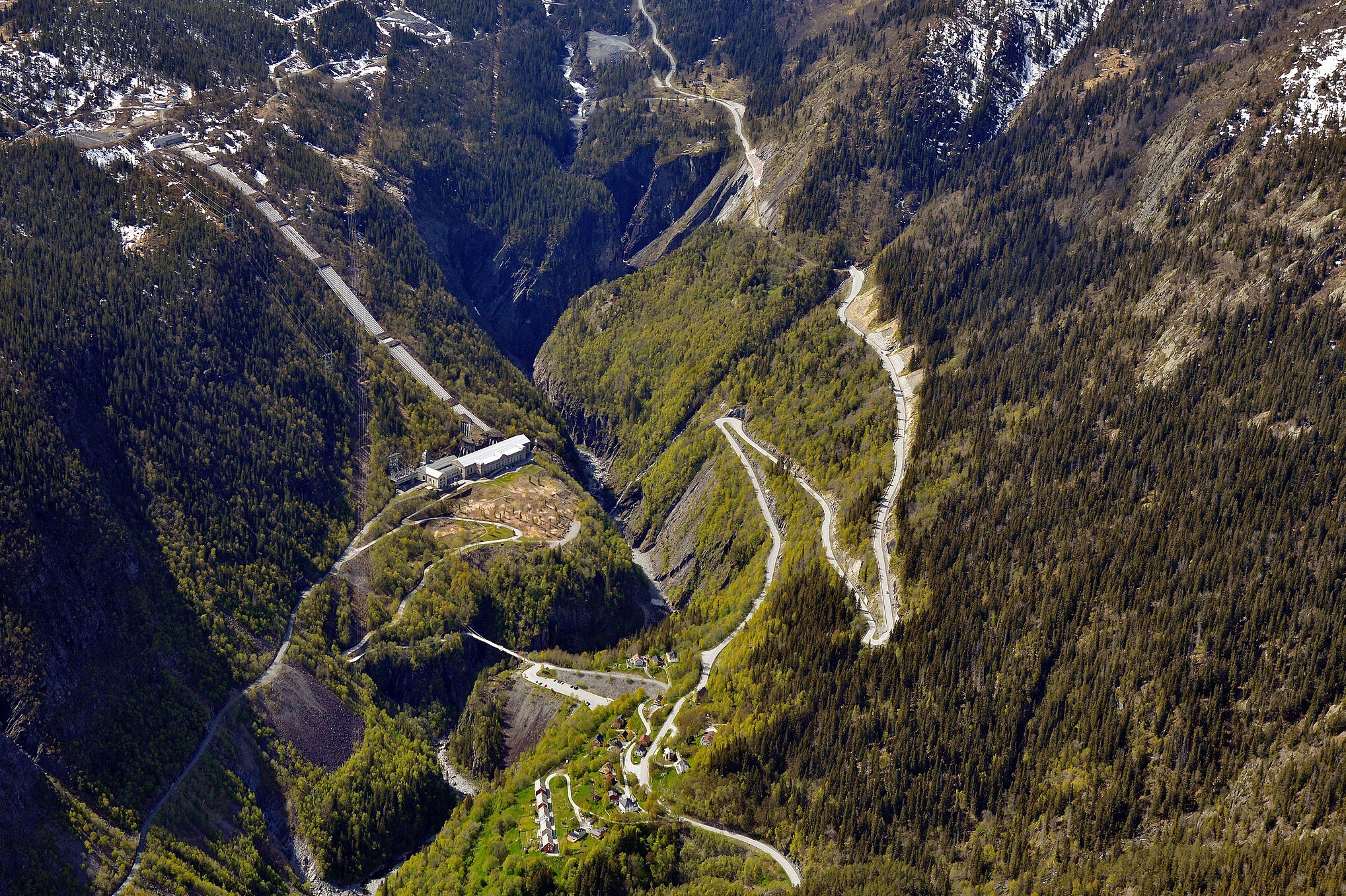
The bends down towards Vemork
We stop at the bends down towards Vemork. This is still a dangerous road, so drive carefully! When you stop here, look towards Vemork and the unique view around. Vemork was designed by architect Olav Nordhagen and was completed in the fall of 1911.
Vemork
The story of Vemork is a well-known chapter in books on both industrial and war history. The Rjukan waterfall provided the foundation for Vemork, the world’s largest power station in 1911, and today you can experience the industrial adventure at the Norwegian Industrial Workers’ Museum – Vemork, about the revolution that took place at Rjukan at the time. During the war, Vemork was the site of Norway’s largest sabotage operation “Heroes of Telemark”. Take a trip to Vemork and experience the exhibitions about industry and “Heroes of Telemark”.
Rjukan
Between massive and deep mountains lies the urban community of Rjukan. Here you can see the class divide from the origins of the town clearly in the architecture. Workers lived at the bottom in the dark, and white-collar workers further up where the sun came first. Today, Rjukan is known for its proximity to Gaustatoppen, its industrial history, Vemork and its unique location at the bottom of the valley. In 2013, the “sun mirror” was built to bring the sun to the people.
Rjukan Business Park
On the large factory sites around Rjukan Business Park, there are buildings with different functions, many of which are of high architectural quality. Rjukan Business Park currently houses 30 different companies on 110 acres of land and 30,000 square meters of office space.
Torget in Rjukan
Torget in Rjukan was designed by architect Torvald Astrup and built in 1924. Its function is as a building for public services and functions, such as the post office, telegraph, library and more. Among other things, the post office was completed in 1921 and also houses a telephone exchange, telegraph, office and pharmacy. It was a stately building and was thus named Lakkskoen. The town’s statue is by Sam Eyde and was unveiled in 1920.
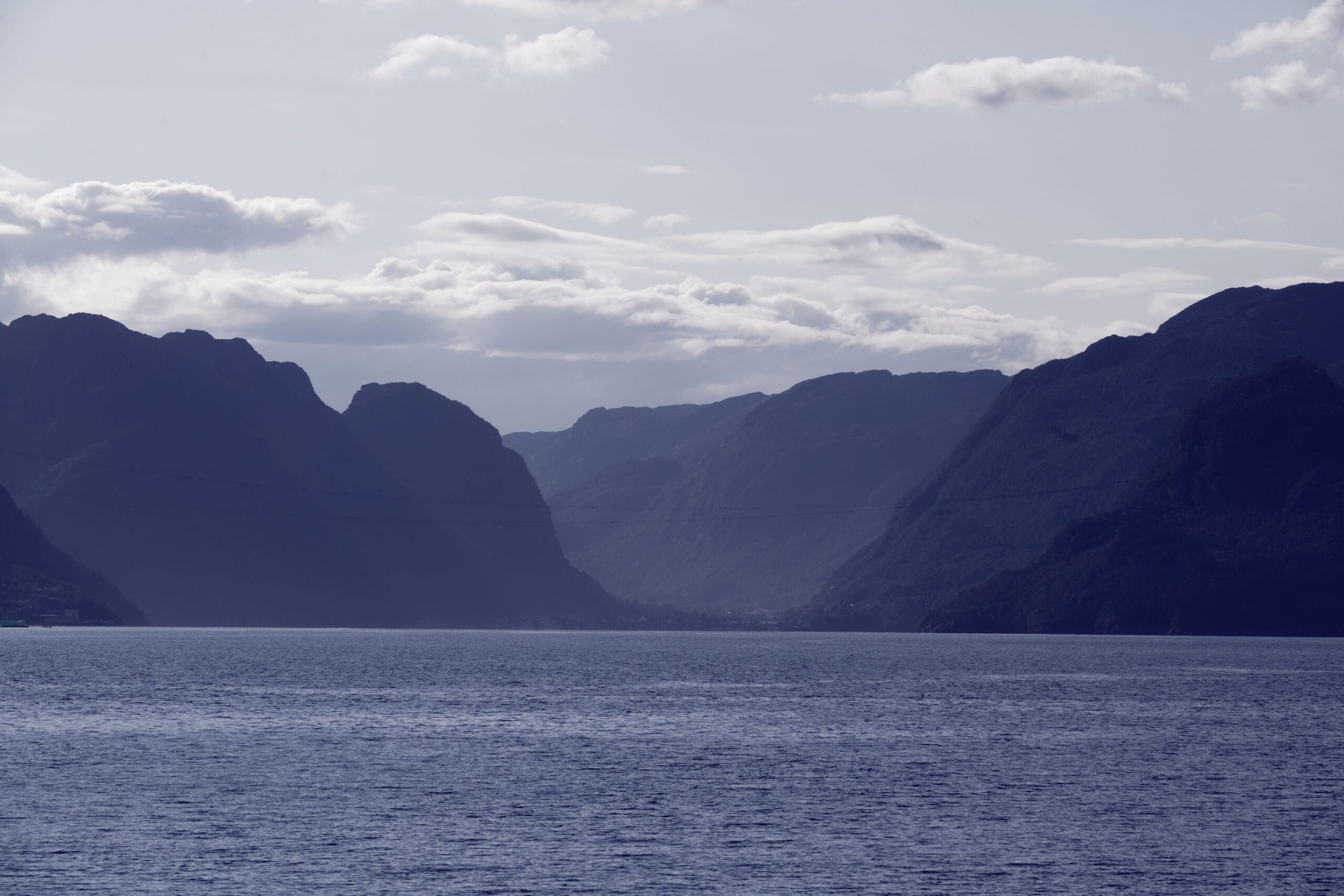
Tinnsjøfergene
Transport from the factories at Rjukan was by train carriages down to Tinnsjøfergene. The Tinnsjø ferries once served the railway line on Lake Tinnsjå, which linked the Rjukan Railway and the Tinnos Railway. In the line of ships that have operated on Tinnsjøen there are now two left; Storegut and Ammonia, both of which are listed.
Along Tinnsjøen
The ferry Hydro was sunk here by Norwegian saboteurs during the Second World War to stop the Germans getting hold of heavy water. Unfortunately, there were also civilians on board the ferry during the sinking, and now the site is a protected cemetery that shines a light of peace on the memory of those who were sacrificed.
Tinnoset
To get fertilizer from Norsk Hydro out into the world, a railway had to be built from Tinnoset down to Notodden. The line is a full 30 km long, and it was a very demanding and sometimes daring project. Construction work was carried out at a rapid pace, and limited rail traffic was possible after just one year.
Notodden
Notodden, the town where Norsk Hydro started. The population grew roughly tenfold between 1900 and 1910, all the way to 8,000 inhabitants. Much of the town center here was built in the then modern Art Nouveau style. Notodden is located by Heddalsvannet and the eastern end of the Telemark Canal, and is today known for both industry and the blues.
Tinfos Paper Factory
Welcome to the old Tinfos Paper Factory. This cultural environment was protected in 2014 and is part of the World Heritage Site. Tinfos Paper Mill is now a museum, so we recommend that you visit the World Heritage exhibition here.
Hydroparken
Hydroparken was established by Norsk Hydro in 1905, when Norwegian pioneers Sam Eyde and Christian Birkeland developed a method for producing synthetic nitric fertilizer from nitrogen. This required large hydropower resources, which they obtained by developing Svelgfossen at Notodden. Today, Hydroparken rents out office space to industrial and creative industries.
End of the tour. Thank you for the tour and welcome again!