Straand Hotel
Turen starter på ærverdige Straand Hotel. Helt siden de første skysskarene tok inn på Straand i 1864, har Straand Hotel sørget for trivsel og god service med gjesten i fokus. Gjestfriheten og de gode tradisjonene er gitt videre fra generasjon til generasjon, og over 150 år seinere kan man fortsatt føle seg hjemme når en er her. En helt spesiell atmosfære finner du i gamledelen som lever videre som en sentral del av det nye hotellet. Hadde de solide tømmerveggene i de trivelige stuene talt, ville de hatt mangt å fortelle om tidligere tiders liv og virksomhet. Straand har en interessant og fargerik fortid som dagens 5.generasjon vertskap, Katrine & Lars Arne Straand, både er stolt av og ønsker å føre videre.
Dalen
Turen går videre til Dalen med stopp på nok et hotell med historisk sus. Hotellet, som også er kjent som «eventyrhotellet» ble bygget i 1894, og har en overdådig, romantisk stil med dragehoder, tårn, spir, altaner, utspring og gesimser. Dalen er endestasjon for Telemarkskanalen, som er vannveien fra Skien, og som når den sto ferdig ble kalt «verdens åttende underverk» i europeiske reisehåndbøker.
Møsvatn
Velkommen til vakre Møsvatn. Møsvatn er Vestfold og Telemarks største innsjø, og en del av Hardangervidda. Med sin beliggenhet på 900 moh er det Skandinavias høystliggende innsjø. Møsvatn og områdene rundt kan skilte med fisk i vannet og rein på vidda. Nyt utsikten og nyt naturen på veien videre mot det industrielle eventyret langs vannveien
Krokan
Krokan er Norges første turisthytte, og et veldig viktig utgangspunkt for det den Norske Turistforening er i dag. Dette er et av de opprinnelige stedene for begrepet «det er typisk norsk å gå på tur» som var noe byfolk kom hit til Krokan for å gjøre i gamledager.
Maristigen
Turen har kommet til Maristigen. Et uhyggelig bratt, men spennende juv som går rett ned fra siden under Rjukanfossen. Maristigen er en gammel ferdeselvei og noe av det råeste Telemarksnaturen har å by på.
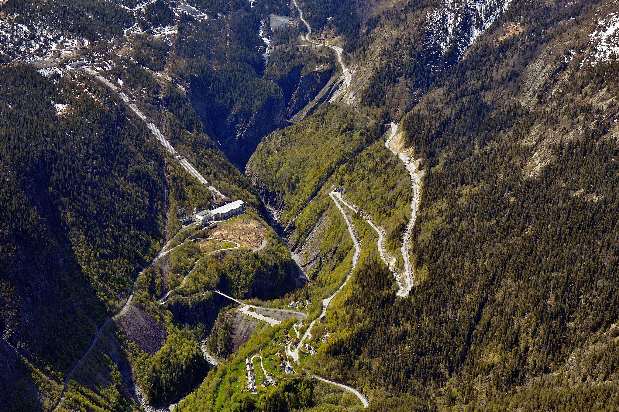
Svingene ned mot Vemork
Vi legger inn en stopp i svingene ned mot Vemork. Dette er fortsatt en farlig vei, så kjør forsiktig! Når du stopper her, se bort mot Vemork og det unike skue rundt. Vemork ble tegnet av arkitekten Olav Nordhagen, og det sto ferdig høsten 1911.
Vemork
Historien om Vemork er et kjent kapittel i bøker om både industri og krigshistorie. Rjukanfossen ga grunnlaget for Vemork, verdens største kraftstasjon i 1911 og her kan man i dag oppleve industrieventyret på Norsk Industriarbeidermuseum – Vemork, om revolusjonen som fant sted på Rjukan den gangen. Under krigen var Vemork stedet hvor Norges største sabotasjeaksjon «helter i Telemark» fant sted. Ta en tur til Vemork og opplev utstillingene om industri og om «helter i Telemark».
Rjukan
Mellom massive og dype fjell ligger bysamfunnet Rjukan. Her kan man se klasseskillet fra opprinnelsen av byen tydelig på arkitekturen. Arbeidere bodde lengst ned i mørket, og funksjonærene lenger opp der sola kom først. I dag er Rjukan kjent for nærheten til Gaustatoppen, industrihistorie, Vemork og den unike beliggenheten i bunnen av dalen. I 2013 ble «solspeilet» bygget for å bringe sola til folket.
Rjukan Næringspark
På de store fabrikkområdene rundt Rjukan Næringspark finnes det bygninger oppført i ulike funksjoner, og mange av dem er av høy arkitektonisk kvalitet. Rjukan Næringspark huser i dag 30 ulike firmaer på 110 mål med landeiendom og 30000 kvadrat kontor.
Torget i Rjukan
Torget i Rjukan er tegnet av arkitekten Torvald Astrup, og ble oppført i 1924. Funksjonen er bygninger for offentlige tjenester og funksjoner, som post, telegraf, bibliotek med mer. Posthuset var blant annet ferdig i 1921 og rommer i tillegg telefonsentral, telegraf, kontor og apotek. Det var en staselig bygning og fikk dermed navnet Lakkskoen. Byens statue er av Sam Eyde og ble avduket i 1920.
Tinnsjøfergene
Transporten fra fabrikkene på Rjukan gikk med togvogner ned til Tinnsjøfergene. Tinnsjøfergene betjente i sin tid jernbanestrekningen på innsjøen Tinnsjå som knyttet sammen jernbanen på Rjukanbanen og Tinnosbanen. I rekken av skip som har trafikkert på Tinnsjøen er det nå to igjen; Storegut og Ammonia, som begge to er fredet.
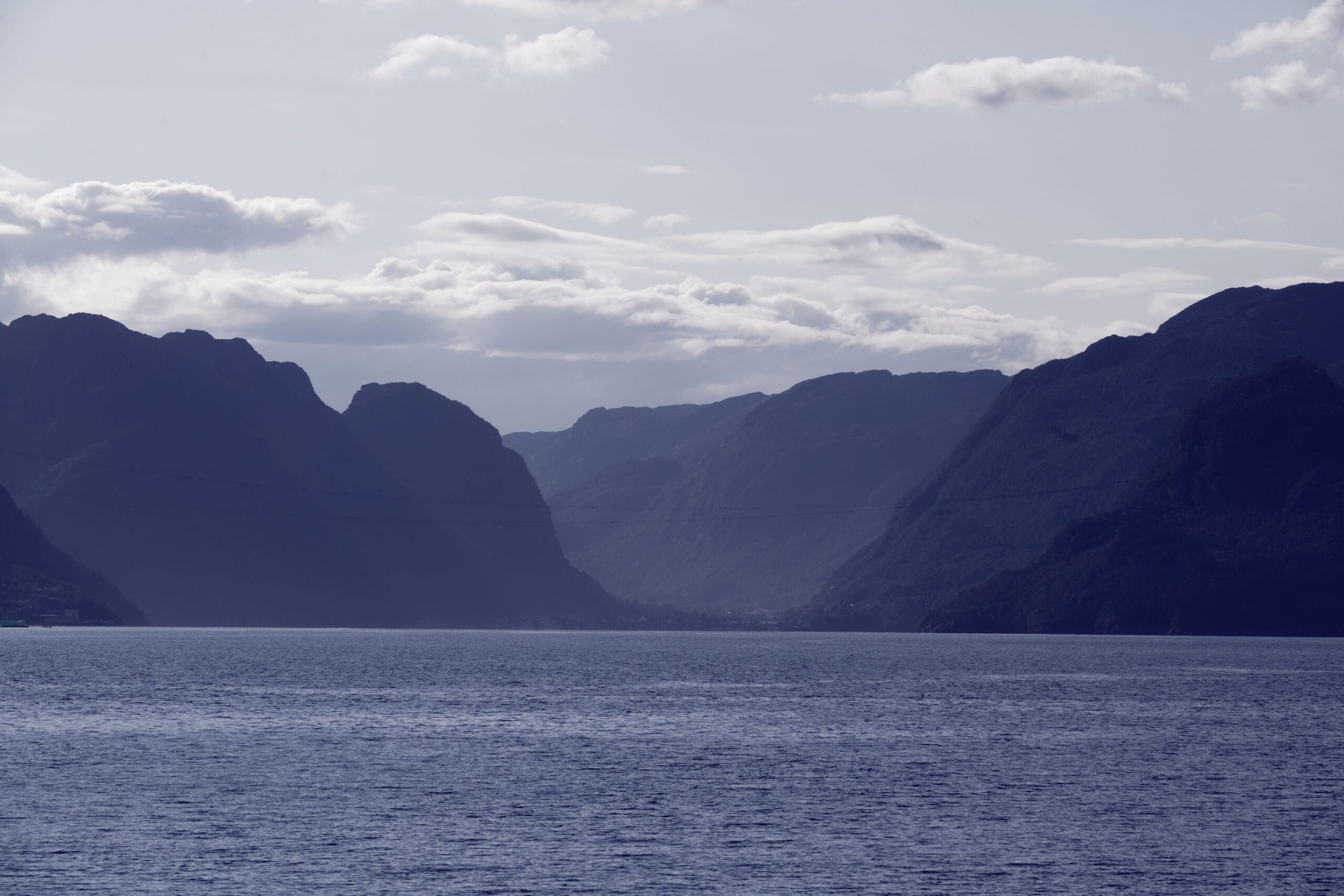
Langs Tinnsjøen
Her ble fergen Hydro senket av norske sabotører under andre verdenskrig for å stoppe tyskerne i å få tak i tungtvann. Dessverre var det også sivile ombord på fergen i senkningen, og nå er stedet en fredet gravplass som lyser fred over minne til dem som ble ofret.
Tinnoset
For å få kunstgjødsel fra Norsk Hydro ut i verden så måtte det bygges en bane fra Tinnoset og ned til Notodden. Banestrekningen er på hele 30km, og det var et svært krevende og til dels dristig prosjekt. Anleggsarbeidet ble drevet frem i raskt tempo, og allerede etter et års tid var det mulig med begrenset skinnetrafikk.
Notodden
Notodden, byen der Norsk Hydro startet. Folketallet ble omtrent tidoblet mellom 1900 og 1910, helt til 8000 innbyggere. Mye av bykjernen her ble bygget i den da moderne jugendstilen. Notodden ligger ved Heddalsvannet og ved østløpet av Telemarkskanalen, og er i dag kjent for både industri og blues.
Tinfos Papirfabrikk
Velkommen til gamle Tinfos Papirfabrikk. Dette kulturmiljøet ble fredet i 2014, og er en del av verdensarven. På Tinfos papirfabrikk i dag er det nå et museum, så det anbefales og gå inn her og se utstillingen som gjelder verdensarven.
Hydroparken
Hydroparken ble etablert av Norsk Hydro i 1905, da de norske pionerene Sam Eyde og Christian Birkeland hadde utviklet en metode for å kunne fremstille syntetisk salpetergjødsel fra Nitrogen. Til dette krevdes det store vannkraftressurser og dette fikk de ved å bygge ut Svelgfossen ved Notodden. Hydroparken i dag leier ut kontorlokaler til bransjer innen industri og kreative næringer.
Avslutning av turen. Takk for turen og velkommen igjen!