HubridingGranavolden

Granavollen Rundt South

Route 2

Granavollen Rundt South

A great day trip with a starting point at Granavollen. The route goes past Sløvika Camping and can therefore also be started from there.

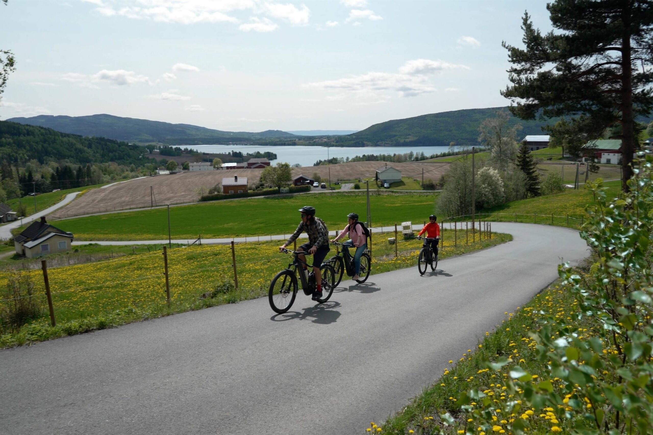
The route is defined as easy

Routes defined as easy are suitable for everyone regardless of experience.

Time
2:30 hours

Length
32 km

Popularity
7.5 av 10

Assessed by the number of clicks on this page in the last two weeks compared to all Hubriding routes.

Route 2: Granavollen Rundt South

 Granavollen-Rundt.gpx  67 KB
Download

It is recommended that the GPS is set to select the fastest route and any avoidance turned off for the route to be calculated as described.

This 32-kilometer round trip is suitable for those who want an easy and comfortable bike ride. With around 600 vertical meters in total, there are few demanding climbs and the surface is a mix of asphalt and gravel. This gives you a varied experience, while the modest length and moderate difference in altitude make the trip feasible for most people.

The tour is mainly on small and cozy roads on asphalt and gravel. There are few cafés and shops along the way, so bring a packed lunch and enjoy the most beautiful landscape Hadeland has to offer.At Sløvika Camping there is a kiosk and the opportunity to swim in Randsfjorden before heading back to Granavollen. At Granavollen itself, there’s plenty to experience in the summer: The sister churches are open for visits, Glasslåven welcomes visitors and Telthuset is open to anyone who wants to learn a little more about the history of Hadeland. Dinner options can be found at one of the 3 hotels located on Granavollen. Of course, you can also spend the night here.

Support

How can I navigate the route?

This primarily depends on whether you have a GPS installed, navigate by App on your mobile phone or prefer paper printing.
Here we describe the most common workflows:

  • Download the GPX file for the route of your choice to your computer
  • Import the file to your route planning tool (e.g. Garmin’s Basecamp or Tom Tom’s MyDrive)
  • Export the route to your GPS in the usual way
  • Check that the route is calculated correctly in your GPS (It is recommended that the GPS is set to select the fastest route and any avoidance is turned off for the route to be calculated as described).
  • Have a good trip!
  • Download the GPX file for the route of your choice to your mobile phone
  • Send/open the file in the app that belongs to your GPS model (e.g. Garmin’s Drive or Tom Tom’s MyDrive)
  • Send the route to your GPS (follow instructions that come with your GPS and App)
  • Check that the route is calculated correctly in your GPS (It is recommended that the GPS is set to select the fastest route and any avoidance is turned off for the route to be calculated as described).
  • Have a good trip!

Many of the routes on Hubriding use the app Ride with GPS app for route planning and navigation of the routes.
You can download a free version or pay for extended use.
Click on the Send to Device link on the map on this page, when the app has started and you see the current route, press Navigate and then just follow the route.

  • Click on the link in the map on the page and the map will open in a new window
  • Print the map, with or without description
  • Have a good trip!