Route 1
Venlifjell
The route is defined as normal
Routes defined as normal are suitable for most people who have experience with somewhat demanding partiesTime
5:00 hours
Length
8.2 km
Popularity
5out of 10
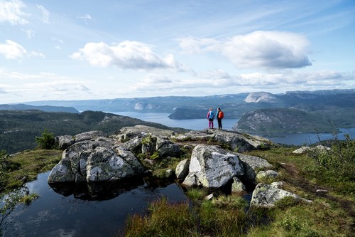
Enjoy a great round trip. It's nice to be able to start in such a beautiful hiking terrain and come to an old seat, the big stone and another seat. Here you can stop and enjoy the food and drink you've brought with you. The hike then goes up the mountain, again with fantastic views on all sides.
The hike starts in fine hiking terrain on a path/old cart road before reaching an old seat, the large stone and another seat.
Nice to take breaks along the way and enjoy snacks and drinks.
The climb up to the summit awaits with a fantastic view, now it's time to take some photos.
The start of the descent is a little steep in some places, but there are ropes to hold on to for those who need them.
A stop at Venelitjørni is part of the tour. Here you'll find swimming and fishing opportunities, a picnic area with a fire pit, rest hut and outhouse.
Enjoy one of Vrådal's best organized hiking destinations. Remember to pay tolls on the way up to the parking lot.
Support
How can I navigate the route?
This depends primarily on whether you have installed a GPS, navigate by App on your mobile phone or prefer paper printouts. Here we describe the most common workflows:
- Download the GPX file for the route you want to your computer
- Import the file to your route planning tool (e.g. Garmin's Basecamp or Tom Tom's MyDrive)
- Export the route to your GPS in the usual way
- Check that the route is calculated correctly in your GPS (It is recommended that the GPS is set to select the fastest route and any avoidance turned off for the route to be calculated as described).
- Have a great trip!
- Download the GPX file for the route you want to your mobile phone
- Send/open the file in the App that belongs to your GPS model (e.g. Garmin's Drive or Tom Tom's MyDrive)
- Send the route to your GPS (follow the instructions that come with your GPS and App)
- Check that the route is calculated correctly in your GPS (It is recommended that the GPS is set to select the fastest route and any avoidance turned off for the route to be calculated as described).
- Have a great trip!
Many of the routes on Hubriding use the app Ride with GPS app for route planning and navigation of the routes. You can download this as a free version or pay for extended use. Click on the Send to Device link on the map on this page, when the app has started and you see the current route, click Navigate and then just follow the route.
- Click on the link in the map on the page and the map will open in a new window
- Print the map, with or without description
- Have a great trip!