Warning: foreach() argument must be of type array|object, bool given in /var/www/vhosts/hubriding.no/httpdocs/wp-content/plugins/hubriding_cf/includes/php/hub_dynamic_return.php on line 12

Route 6

Trollstigen

Route 6 is an adventure route in its own right, taking in all the big ones like Ørnevegen. Delightful Valldal up to Trollstigen and the lookout point, Åndalsnes, Trollveggen, Slådalsvegen over to Vågamo and the north side of Vogåvatn to charming Lom and on over Strynefjellet to spectacular Dalsnibba before landing in Geiranger, a full day of great experiences!

The route is defined as normal

Routes defined as normal are suitable for most people who have experience with somewhat demanding sections.

Length
334 km

Popularity
7.5 av 10

Assessed by the number of clicks on this page in the last two weeks compared to all Hubriding routes.

Route 6: Trollstigen

 Geiranger-rute-6.gpx  332 KB
Download

It is recommended that the GPS is set to select the fastest route and any avoidance turned off for the route to be calculated as described.

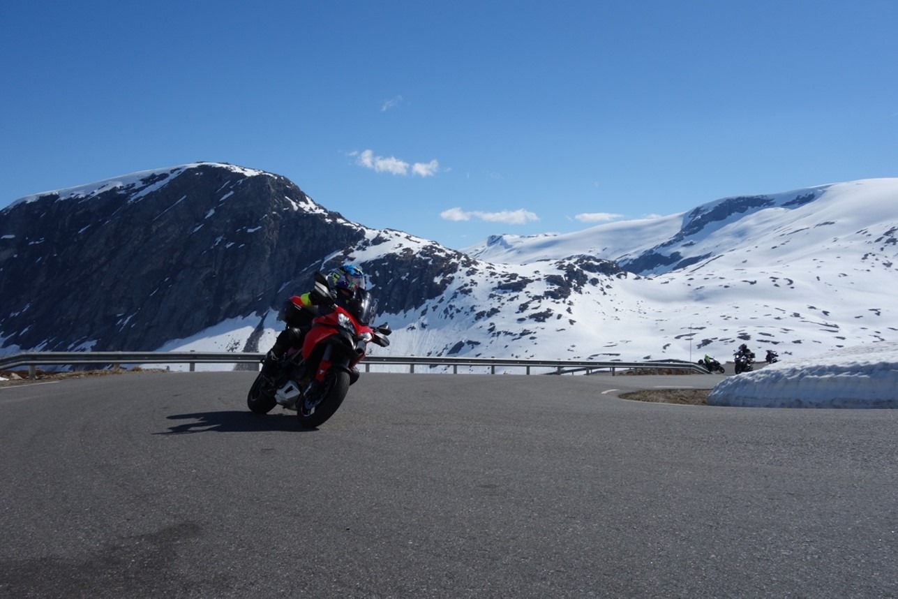
This route is rich in great driving and nature experiences and you should make sure you have enough time to enjoy all the sights, you shouldn't just drive past them!
In terms of driving technique, this route is not particularly difficult, but you should have some driving experience to enjoy it.
If you don't have experience, you'll certainly get a lot out of this trip, which is usually done on an adventure bike.
The section between Lesja and Lom is on a nice, hard-packed gravel road.

It’s always fun to drive up Ørnevegen, but one of the driving highlights is definitely the climb from Valldal up to the Trollstigen viewpoint, which is simply spectacular.
The wow factor continues on the way down to Åndalsnes where you can enjoy the ride to Romsdalseggen by cable car, or thunder on up Romsdalen to enjoy the Troll Wall.
The trip up Romsdalen offers wonderful bends and intense sensory impressions that indicate that the radar should be turned on because you need to get this in addition to the driving experience!
At Lesje you turn onto Slådalsvegen which takes you over to Vågåmo, a fantastic mountain pass that is especially fun to drive for those who also like gravel (if you don’t like gravel, you can drive around Dombås and Sel over to Vågåmo, also fun).
From Vågåmo, the tour follows the north side of Vågåvatnet down to charming Lom, which in every way is a delight for the taste buds, here you’ll find lots of goodies for the taste buds!
The trip from here goes through a quiet section to Skjåk, where you can stop at a private tractor museum just after you pass Nordberg, or enjoy the utterly delightful “sweepers” on the way up to Grotli and eventually the trip’s perhaps greatest highlight, which is Dalsnibba, an experience not to be missed!
From here you have approx.
From here you have approx. 100 very fun turns back down to the hotel where you can enjoy new taste experiences or perhaps a spa treatment in the wonderful facility after a long day in the seat.
You’re sure to sleep well!

Support

How can I navigate the route?

This primarily depends on whether you have a GPS installed, navigate by App on your mobile phone or prefer paper printing.
Here we describe the most common workflows:

  • Download the GPX file for the route of your choice to your computer
  • Import the file to your route planning tool (e.g. Garmin’s Basecamp or Tom Tom’s MyDrive)
  • Export the route to your GPS in the usual way
  • Check that the route is calculated correctly in your GPS (It is recommended that the GPS is set to select the fastest route and any avoidance is turned off for the route to be calculated as described).
  • Have a good trip!
  • Download the GPX file for the route of your choice to your mobile phone
  • Send/open the file in the app that belongs to your GPS model (e.g. Garmin’s Drive or Tom Tom’s MyDrive)
  • Send the route to your GPS (follow instructions that come with your GPS and App)
  • Check that the route is calculated correctly in your GPS (It is recommended that the GPS is set to select the fastest route and any avoidance is turned off for the route to be calculated as described).
  • Have a good trip!

Many of the routes on Hubriding use the app Ride with GPS app for route planning and navigation of the routes.
You can download a free version or pay for extended use.
Click on the Send to Device link on the map on this page, when the app has started and you see the current route, press Navigate and then just follow the route.

  • Click on the link in the map on the page and the map will open in a new window
  • Print the map, with or without description
  • Have a good trip!