The route is defined as demanding
Routes defined as demanding are suitable for people with experience in demanding parties.Time
6:00 hours
Length
318 km

Popularity
4.7 av 10
Follow the map and also read the description and sections on access to each of the facilities. Have a good trip and feel free to have a good cup of coffee on the way. Local gas stations delivering 98 octane
Check out the Norwegian-developed app Refuel provided by AMCAR in collaboration with High Octane AS for iOS and Android phones.
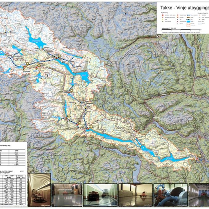
The core of the Tokke development was the idea of using the 600 m drop between lakes Totak in Vinje and Bandak in Tokke municipality.
But both above and below Totak, there were lakes, rivers and waterfalls that were suitable for damming as reservoirs in a larger regulation area.
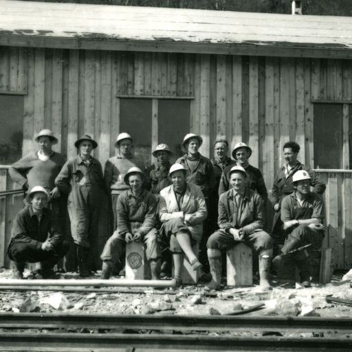
In 1956, the starting shot was fired for what was then Northern Europe’s largest power development project.
With money from the World Bank, the state, the county and some municipalities, a construction period that lasted until 1969 (later extended to 1979) began that turned life and the economy in upper Telemark upside down.
7 power stations and 37 dams were built.
In 1987, another power station (Hogga) was added further down the Telemark Canal.
The Tokke regulation area covers a catchment area of 3104 square kilometers.
This means that as much as 3.3 billion cubic meters of rainwater flows into the watercourse every year and produces electricity several times on its way down the watercourse.
In total, the Tokke system delivers 4.4 TWh (terrawatt hours) a year, enough to supply over 200,000 households with electricity!
Statkraft manages the entire system. VEST-TELEMARK Museum, Eidsborg This museum has its own exhibition that tells the story of the Tokke development through film, animation and pictures.
There is also an installation that shows how reservoirs, dams, pipelines and power stations are connected and controlled to achieve maximum benefit from the rainwater over the huge area.
This creates the “battery effect” where water can be stored for several years for later use.
The large rivers in Austlandet do not have this possibility, and can only produce water while the river is flowing.
The museum offers guided tours of this part of the exhibition on request, but the other exhibitions are also worth checking out before jumping in the car and getting out the map.
Eidsborg stave church is a gem here in West Telemark and is located in the museum area.
Tours, guided tours and maps can be booked at the reception at Straand Hotel.
Here you will also get tips on lunch stops and other attractions along the way.
Expect a round trip of approximately 5-5.5 hours.
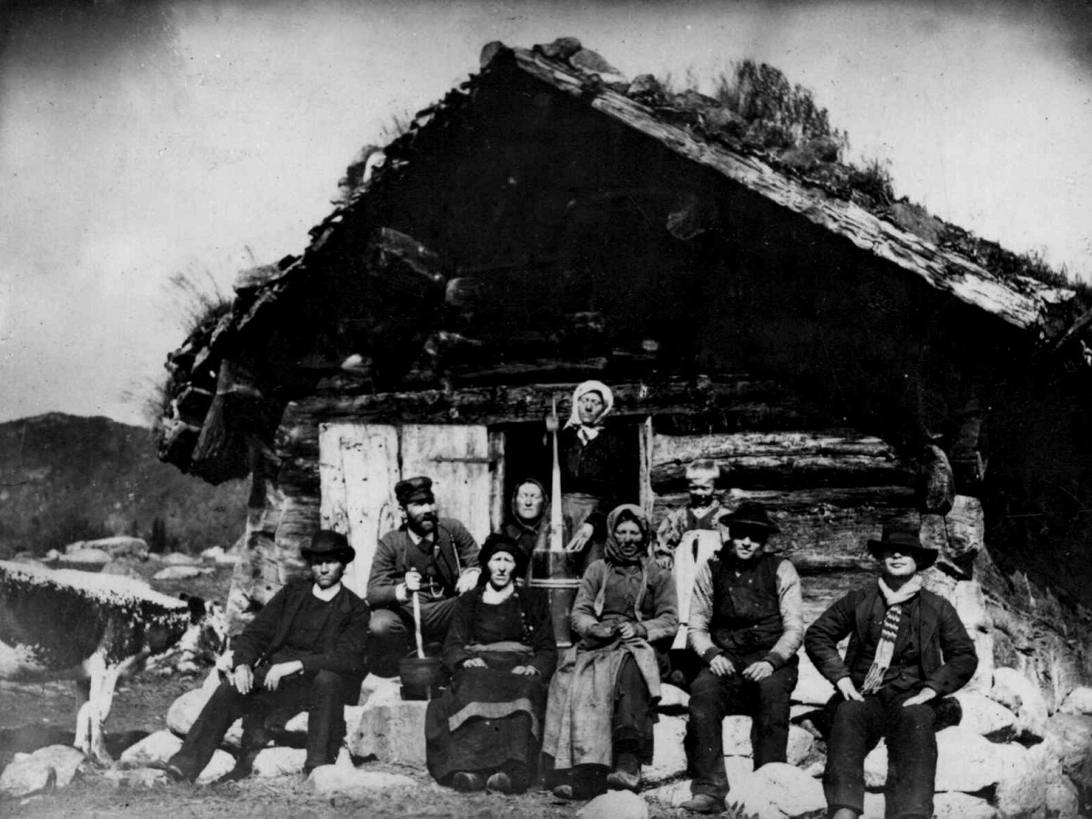
A large part of the route is in the high mountains and can offer different weather… maybe bring a warm jacket. 1 BOTNEDALSDAMMEN Botn(e)dalen in Mo – today Tokke municipality – has always been a transportation route between upper Telemark and Setesdalen, and on to Western Norway.
There was a lot of trade and cultural exchange here, and ancient settlements.
Yarn was mined here, and reindeer have their own migration area here (Setesdal-Austhei).
Until the middle of the 17th century, there is said to have been a separate village in Botnedalen.
There is also said to have been a stave church here.
But after “Hardæva”, a climate crisis triggered by several volcanic eruptions in the Pacific Ocean between 1639 and 1644, the valley was abandoned.
The church was demolished, and today only the church door remains.
A reconstruction of the door can be seen at Vest-Telemark Museum in Eidsborg.
In the 1800s, the Botnedalen valley in the old “Moe Sogn in Thellemarken” was known to be particularly idyllic.
For example, the priest Simon Olaus Wolff called it “a beautiful valley” and “a fine mill [jomfru] in a sword-run [sverdbiten] giant’s arm”[Brudstykker af en Thellemarksvandring i sommeren 1822]. There were many cairns in Botnedalen.
One of them was Låmyrstaulen, which belonged to the vicarage in Mo.
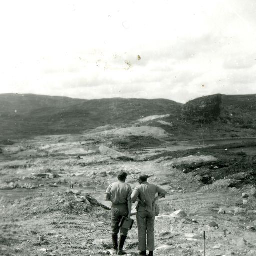
In a famous photograph from the late 1800s, we can see Torbjørg Ripilen, who worked at the vicarage and the pillar for periods.
She was one of those who sang the medieval ballad Draumkvedet for folklore researchers Moltke Moe and Sophus Bugge in 1890.
When the Botnedalsdammen dam was completed in 1969, as part of the major Tokke power station development, large parts of Botnedalen were flooded.
These dams, of which there were several, triggered the first public disputes about nature and culture conservation in Norway in the 1960s.
Visual artist Dyre Vaa, for example, questioned whether it was right to dam up valuable nature and ancient cultural monuments.
But there were also those who defended the development.
The author Tarjei Vesaas wrote in 1958: “No one has the right to condemn their fellow man to live in a museum. Old houses are beautiful, but it’s different for a housewife who has to work there. There, technology breaks in like a blessing. Not everything about the old is good because it’s old…” Today, the water from Botnedalsvatnet, with inflow from Strandstøylsdalsvatnet, is used for power generation at Byrte power station, and several times on the way down into the Telemark watercourse.
The capacity of the turbine in Byrte is 25 MW, and the annual production is 112 Gwh.
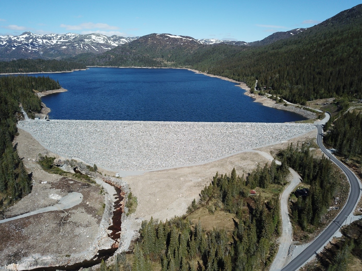
Emergence: The picture from Botnedalen dam (image) is located at the south end of Botnedalsmagasinet in Tokke municipality.
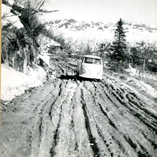
The dam is 10-12 km west of Dalen, and parts of the road are toll roads with cash registers or Vipps.
The road consists of stretches of asphalt and gravel.
The toll roads to Songa and Botnedalen are dead ends, with no possibility of driving through. 2 VENEMO Venemodammen is one of the many dams in the major Tokke development and was completed in 1963.
It dams up the water in Lake Venemo, which comes all the way from Bordalsvatnet 200 meters further up.
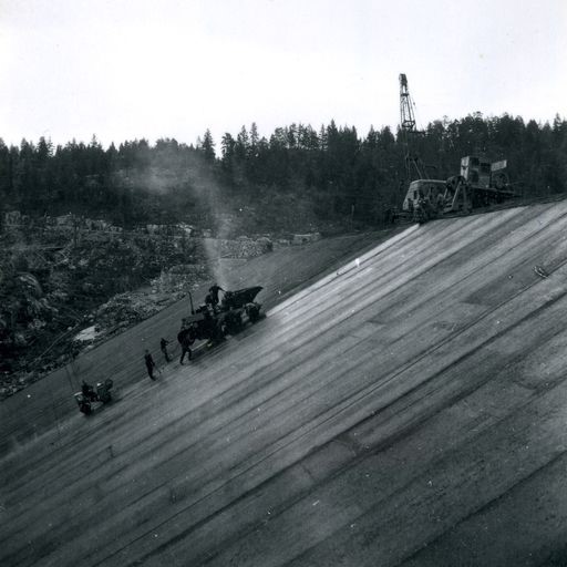
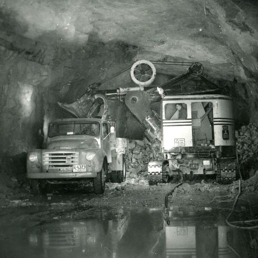
The Venemo dam is the first embankment dam in Norway to be filled with asphalt concrete.
In the photographs by NVE’s photographer Jostein Granlid, you can see how it happened.
The dam has a unique ring-shaped spillway that rises up from the bottom and can be a spectacular sight at high water levels.
The spillway is of the “Morning Glory Spillway” type, which can be found at a number of well-known dams around the world.
A tunnel has been blasted out of the Venem dam to carry the water on to Totak and Våmarvatn, which is the intake reservoir for Vinje power station, the second largest after Tokke power station in the development, with an outlet to Vinjevatnet.
The power station was commissioned in 1964 and produces 1017 Gwh with a turbine output of 300 MW.
The three 100 MW turbines each have their own pressure shaft with a drop of 225 m.
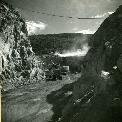
Arrival: Venemo dam (aerial photo) is located 3-4 km from Haukeli on FV 362 on the way to Rauland. 3 SONGADAMMEN Songa Dam was completed in 1962.
The impounded Songavatnet lake is originally made up of 11 smaller lakes.
Two dams keep the lake in place: Trolldalsdammen and the main dam (Songadammen) here at Naustnuten.
Songadammen is more than 1 km long, 37 m high and was for a long time the largest rockfill dam in Norway.
The dam took four years to build and is an impressive sight to this day.
The overflow goes via the river Songa to Lake Totak. The water from Songa dam contributes to power production at Songa power station, which opened in November 1964.
It receives water through tunnels from three different lakes: Bitdalsvatnet, Kvikkevatnet and Songavatnet.
The pressure shaft from Songavatnet down to the power station has a drop of 287 m and has an outlet in Totak.
The turbine was the largest of its time and delivers 140 MW.
Average annual production is 575 Gwh.
Emergence: The Songa dam (picture) has a spillway approx.
2 km further from Venemo dam.
This road is 6-7 km long and a combination of asphalt and gravel.
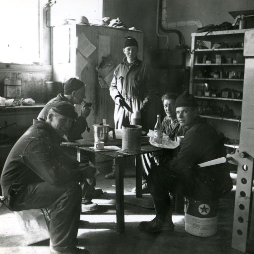
This is a toll road with electronic registration. 4 HAUKELI POWER PLANT Haukeli was the first power plant in the Tokke development and was opened in 1957.
It is located in the river Vai, between Vatjønn and Flothylåi, and has Langeidvatn as its regulating reservoir.
The power station also receives water from Gurivatn.
The tunnel from Vatjønn is 215 m long and has a drop of 268 m.
The power station was built with a view to supplying the construction work in the Tokke development with electricity, and the plan was to demolish it after the construction period.
But Haukeli remained in operation for a full 55 years before it was replaced by a new power plant in 2013.
Today it generates around 5 MW and is the smallest in the Tokke system, with an annual production of 38 GWh.
Image: Haukeli power plant (image) is located approx.
500 m west of the river in Haukeli center.
Access via bridge at the intersection of the R9.
Support
This primarily depends on whether you have a GPS installed, navigate by App on your mobile phone or prefer paper printing. Here we describe the most common workflows:
Many of the routes on Hubriding use the app Ride with GPS app for route planning and navigation of the routes. You can download a free version or pay for extended use. Click on the Send to Device link on the map on this page, when the app has started and you see the current route, press Navigate and then just follow the route.
