Warning: foreach() argument must be of type array|object, bool given in /var/www/vhosts/hubriding.no/httpdocs/wp-content/plugins/hubriding_cf/includes/php/hub_dynamic_return.php on line 12
HubridingFlatland

Coastlines and cultural treasures

Route 5

Coastlines and cultural treasures

A panoramic tour that connects the Sognefjord with coastal settlements and historical attractions, perfect for island and mountain detours.

The route is defined as normal

Routes defined as normal are suitable for most people who have experience with somewhat demanding sections.

Tid
4:00 timer

Length
200 km

Popularity
7.5 av 10

Assessed by the number of clicks on this page in the last two weeks compared to all Hubriding routes.

From Flatheim to Sande, follow the National Tourist Route through the Gaulardal fjord along the protected Gaular watercourse and through the Hestad landscape conservation area.
You meet the Sognefjord in Vadheim and follow the fjord towards the coast, past Lavik and Hyllestad.
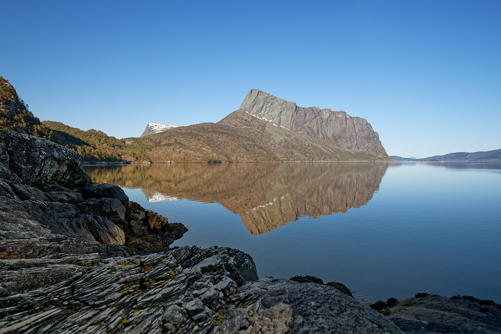
You can admire Lihesten, which rises steeply from the fjord and is 777 m at its highest point.
You then drive through the village of Sørbøvåg and continue along the fjord to Folkestad.
A detour to Korssund and Lammetun, where you can look over to the island of Alden, also known as Norskehesten, which rises 481 meters "straight up" from the sea.
Continue inland along the Dalsfjord through Hellevik, Flekke and Dale.
Back to Sande and on to Flatheim on the same route as you started.

Long description is missing

Support

How can I navigate the route?

This primarily depends on whether you have a GPS installed, navigate by App on your mobile phone or prefer paper printing.
Here we describe the most common workflows:

  • Download the GPX file for the route of your choice to your computer
  • Import the file to your route planning tool (e.g. Garmin’s Basecamp or Tom Tom’s MyDrive)
  • Export the route to your GPS in the usual way
  • Check that the route is calculated correctly in your GPS (It is recommended that the GPS is set to select the fastest route and any avoidance is turned off for the route to be calculated as described).
  • Have a good trip!
  • Download the GPX file for the route of your choice to your mobile phone
  • Send/open the file in the app that belongs to your GPS model (e.g. Garmin’s Drive or Tom Tom’s MyDrive)
  • Send the route to your GPS (follow instructions that come with your GPS and App)
  • Check that the route is calculated correctly in your GPS (It is recommended that the GPS is set to select the fastest route and any avoidance is turned off for the route to be calculated as described).
  • Have a good trip!

Many of the routes on Hubriding use the app Ride with GPS app for route planning and navigation of the routes.
You can download a free version or pay for extended use.
Click on the Send to Device link on the map on this page, when the app has started and you see the current route, press Navigate and then just follow the route.

  • Click on the link in the map on the page and the map will open in a new window
  • Print the map, with or without description
  • Have a good trip!